This is on the wishlist of a political advertisement regulator between US and Canada for possible map making software for federal election results/projections.
We are proposing Observable maps overlaid with Wolfram Mathematica analytix. Wolfram portion has been approved I am trying to deliver the Observable
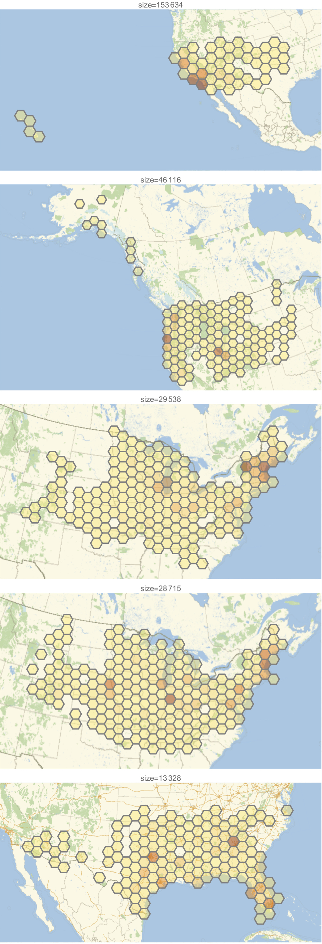
We provided some Observable map applications for the voter response to Ads overlaid with Mathematica algorithms e.g. clustering and anomaly detection and the combo is a winner , please see attached.
However I need to pull off larger more detailed maps, hence my earlier post to ask for larger uploads sizes.
Perhaps you can avoid the huge file by processing that map into TMS tiles? It’s a whole different step, but once you can do it, it really makes working with any map data easier.
You bet. BTW, that link I provided might seem overwhelming… as an alternative I think you can generate tiles with QGIS, which might be easier (UI vs cmd line).
